Press the right arrow icon in the bottom right to advance to the next 10min snapshot.
https://himawari.asia/himawari8-image.htm?sI=D531106&sClC=&s...
You can also download high-res images (11000x11000 PNG):
https://sc-nc-web.nict.go.jp/wsdb_osndisk/shareDirDownload/b... (you might have to click this link twice for the search to work)
The worst one I ever saw was where above the fold items were unchecked, but the below the fold items were checked where you couldn’t see them.
Are you sure that by accepting you aren't just accepting legally to continue to be tracked with all other means?
If true, then deleting cookies only cause them to ask again next time, but you're still fully tracked.
See https://www.kompyte.com/blog/5-ways-to-identify-your-users-w... (just found it) for examples of tracking without cookies.
I guess sending in a letter isn't as good for social media engagement, though.
Could be the BBC's fault, possibly due to in-country legalese though?
https://www.satellitetoday.com/wp-content/uploads/2014/08/PH...
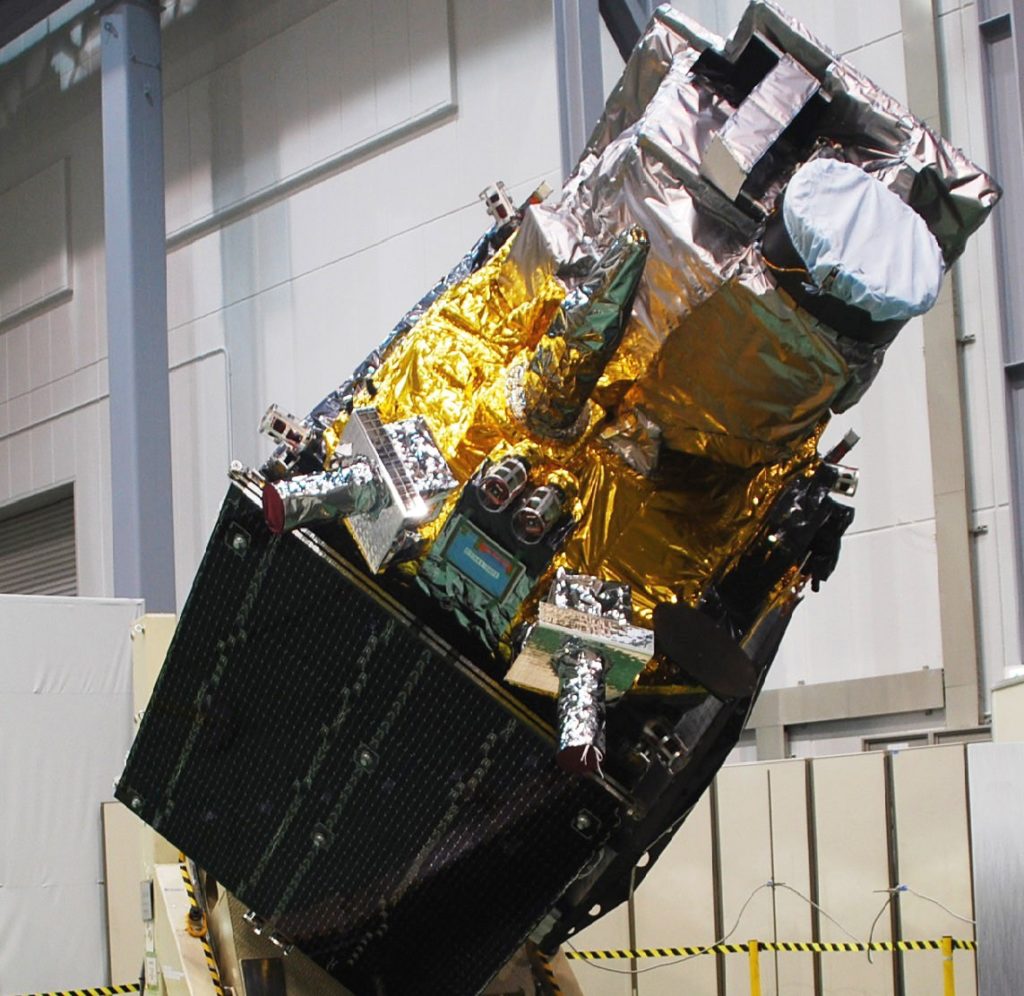
https://space.skyrocket.de/doc_sdat/himawari-8.htm
https://en.wikipedia.org/wiki/Himawari_8#/media/File:Himawar...

https://twitter.com/205mph/status/1482262486535573507
https://twitter.com/Rony_banchero/status/1482440640755556359
https://news.yahoo.com/tonga-issues-tsunami-warning-undersea...
> There were no immediate reports of injuries or the extent of the damage because all internet connectivity with Tonga was lost at about 6:40 p.m. local time — about 10 minutes after problems began, said Doug Madory, director of internet analysis for the network intelligence firm Kentik.
> Tonga gets its internet via an undersea cable from Suva, Fiji, which presumably was damaged. The company that manages that connection, Southern Cross Cable Network, could not immediately be reached for comment.
There are social media posts of the tsunami though which I believe are from Tonga. So folks at the shoreline were presumably fine enough to record and post video somehow.
Tsunami: https://twitter.com/dwnews/status/1482331481607311360
Eruption: https://youtu.be/Eu8V_WADjCw
I’d be worried about anyone on an airplane near there, but I guess it’s not a highly trafficked route.
I was curious whether Fua'amotu International Airport is a stop on flights going elsewhere but I wasn't able to come up with a good search. It sounds like it could be:
"The air field was constructed by Seabees of the 1st Construction Battalion with assistance and labor of the U. S. Army 147th Infantry Regiment. It was intended as a World War II heavy bomber field, and had three coral-surfaced runways. In the late 1970s, it was expanded to permit jet aircraft to use the runways. Fuaʻamotu is now suitable for up to Boeing 767 size aircraft, but remains closed to larger jets (e.g. Boeing 747s)."
It's basically just Australia and New Zealand to Hawaii and North America, and Pacific Islands east of Tonga. As well as any inter-Oceanic flights that happen to pass it.
(the 2019 break was caused by a Turkish oil tanker prematurely dropping anchor in a restricted zone [3])
"DS Venture Ltd (DSV) was the owner of the Duzgit Venture. On 20 January 2019, as the vessel approached the Port of Nuku'alofa, its starboard anchor and chain were prematurely released from their housing. As the anchor and chain were winched back in, they caught and damaged a cable. The cable was one of two undersea communications cables owned by Tonga Cable Ltd (TCL) connecting Nuku'alofa, Ha'apai, and Vava'u with Fiji. As a result of damage to the cable, Tonga was without cable telecommunications for almost three weeks. "
[0] https://samoanews.com/regional/tonga-cable-break-located-rep...
[2] https://matangitonga.to/2019/01/26/geek-heroes-rescue-tonga-...
Here is an animated gif in the relevant timeframe, 9 MB in size.
https://cdn.star.nesdis.noaa.gov/GOES17/ABI/SECTOR/tsp/Sandw...

and one hour earlier
https://cdn.star.nesdis.noaa.gov/GOES17/ABI/SECTOR/tsp/Sandw...

https://rammb.cira.colostate.edu/ramsdis/online/loop.asp?dat...
(Same links, with time windows that go further back)
https://www.star.nesdis.noaa.gov/goes/sector_band.php?sat=G1... (GOES-West)
https://rammb.cira.colostate.edu/ramsdis/online/loop.asp?dat... (Himawari-8)
https://www.star.nesdis.noaa.gov/goes/sector_band.php?sat=G1... (GOES-West)
https://www.star.nesdis.noaa.gov/goes/sector.php?sat=G17&sec...
https://rammb.cira.colostate.edu/ramsdis/online/loop.asp?dat... (Himawari-8)
https://rammb.cira.colostate.edu/ramsdis/online/himawari-8.a...
Edited comment: originally linked to the wrong satellite imagery (from a separate eruption several hours ago). The discussion in this link is still informative, but not current:
https://www.nesdis.noaa.gov/news/hunga-tonga-hunga-haapai-er...