News for hackers. Stuff that matters.
Re:The largest city in each 10x10 degree latitude/longitude box by caf on Thursday June 25, 2020 @08:06AM (#23639670)
I quibble with the description of the shapes bounded by 10 degrees of longitude and latitude as "rectangles" - they're not even planar shapes, and their adjacent sides certainly aren't at right angles. Some of them don't even have four sides.

This bears considering when looking at the map, because some of those regions are much, much smaller than others.

Re:The largest city in each 10x10 degree latitude/longitude box by paulirwin on Thursday June 25, 2020 @06:13PM (#23646362)
Mostly an aside to your comment, but it's somewhat related. This post's divisions of 10° latitude/longitude is pretty close to the Maidenhead grid system, used heavily by amateur radio operators like myself.

The difference is that each top-level grid "square" (to your point, not actually square, but that's what they're called) is 20° longitude by 10° latitude represented by two letters. While the computation of a 4 or more character grid locator code is complex enough that most people can't quite do that in their head, because of them being treated as if they were coordinate "rectangles", it is simple enough to translate lat/lon coordinates to a grid code and vice versa with pen and paper if needed in the case of an emergency, if you know the algorithm or have a reference sheet. The 10° latitude size means that the parallels are the same in the Maidenhead system (for the first two letters of a code) as in this post. It also has the added benefit of knowing that DN is north of DM, which are both west of EM. I've gotten to where I can roughly place someone I hear on the radio based on a mental map of grid codes, and have memorized many grid codes of large population centers.

The beauty of the grid code system is that you can further refine an area by adding on subsequent numbers and letters, much like degrees/minutes/seconds in coordinates, but requiring significantly less characters to read to others over the radio. And, you can use phonetics for the letters, i.e. "delta mike seven niner" (DM79) is roughly the entire Denver metro area. Fort Collins, CO on this parent post falls under DN, above that 10°-sized parallel.

More info on the Maidenhead system: https://en.wikipedia.org/wiki/Maidenhead_Locator_System

Map with two-letter grid codes: https://www.mapability.com/ei8ic/maps/gridworld.php

Re:The largest city in each 10x10 degree latitude/longitude box by NopeNotToday on Thursday June 25, 2020 @08:25AM (#23639839)
He's not making a mathematical definition of the areas. 'area' or 'box' is a simple description that everyone can understand. And the map projection used does form squares.
Re:The largest city in each 10x10 degree latitude/longitude box by chrisseaton on Thursday June 25, 2020 @08:57AM (#23640159)
> And the map projection used does form squares.

Some of those squares have zero-length edges.

Re:The largest city in each 10x10 degree latitude/longitude box by jtbayly on Thursday June 25, 2020 @10:33AM (#23641182)
Which is really cool. Also very confusing!
Re:The largest city in each 10x10 degree latitude/longitude box by beerandt on Thursday June 25, 2020 @11:34AM (#23641866)
Quadrangle is the proper term (at least for four-sided boundaries). Hence the common name for USGS topographic maps: quads.
Re:The largest city in each 10x10 degree latitude/longitude box by tantalor on Thursday June 25, 2020 @03:51PM (#23644792)
> their adjacent sides certainly aren't at right angles

They certainly are. Parallels and meridians always meet at 90 degrees.

https://www.geogebra.org/m/kNtNZzsS

Re:The largest city in each 10x10 degree latitude/longitude box by roelschroeven on Thursday June 25, 2020 @05:28PM (#23645936)
I'm not 100% sure about that. Are angles between circles on a sphere defined by the angles between their tangent lines? If it were true, you could for each point/meridian combination construct an infinite amount of different circles that would all meet at right angles with that meridian (just vary the circle's radius). That doesn't feel quite right.

According to Wikipedia [1], "in spherical geometry, angles are defined between great circles". Meridians are great circles, but parallels are not. Possibly the angle is simply not defined for circles that are not great circles?

[1] https://en.wikipedia.org/wiki/Spherical_geometry

Re:The largest city in each 10x10 degree latitude/longitude box by tantalor on Thursday June 25, 2020 @06:20PM (#23646429)
It only matters what is the angle between the lines tangent to the curves at the point of intersection.

Here's an example: https://www.desmos.com/calculator/is7mush1ma

The red and blue circles are both perpendicular to the green circle at the origin.

Re:The largest city in each 10x10 degree latitude/longitude box by roelschroeven on Friday June 26, 2020 @05:23AM (#23650166)
OK, thanks, today I learned something new.
Re:The largest city in each 10x10 degree latitude/longitude box by doersino on Thursday June 25, 2020 @04:07PM (#23645005)
Right angles with regard to the latitude-longitude coordinate system, but not with regard to the surface of the earth. Recall that all meridians intersect at the poles.
Re:The largest city in each 10x10 degree latitude/longitude box by colanderman on Thursday June 25, 2020 @04:30PM (#23645322)
@tantalor is technically correct; meridians and parallels intersect at right angles, even with respect to the (idealized) surface of the earth. Proof sketch: if the angles involved in a crossing were not all 90°, then either the crossing would not be symmetric about the meridian (it is), or one or both lines must have a sharp "kink" (i.e., have a non-smooth first derivative) at the intersection (neither does).

However, parallels, while smooth, are not straight, they "curl" toward the nearest pole (i.e., non-zero second derivative, relative to the earth's surface). This accounts for the non-"rectangular" shape of quadrangles and can be replicated on a 2D plane.

Re:The largest city in each 10x10 degree latitude/longitude box by tantalor on Thursday June 25, 2020 @04:46PM (#23645501)
Yes with regard to the surface of the earth.

Take the lines tangent to the meridian & parallel at the point of intersection. Observe these lines are perpendicular. Hence the meridian & parallel meet at a right angle.

Re:The largest city in each 10x10 degree latitude/longitude box by doersino on Friday June 26, 2020 @03:35AM (#23649648)
You’re right, I apologize for my smartass answer.
Re:The largest city in each 10x10 degree latitude/longitude box by simonh on Thursday June 25, 2020 @05:38PM (#23646043)
What about the ‘boxes’ where the top edge is, er, the point at one of the poles?
Re:The largest city in each 10x10 degree latitude/longitude box by tantalor on Thursday June 25, 2020 @06:22PM (#23646442)
Yeah not the pole of course, but you can cut them off at at ±89.999 degrees and it still works.
Re:The largest city in each 10x10 degree latitude/longitude box by kgwgk on Thursday June 25, 2020 @06:06PM (#23646314)
> Recall that all meridians intersect at the poles.

How is that relevant regarding “Parallels and meridians always meet at 90 degrees“?

Re:The largest city in each 10x10 degree latitude/longitude box by caf on Thursday June 25, 2020 @08:15PM (#23647344)
Thankyou for the correction.
Re:The largest city in each 10x10 degree latitude/longitude box by mjd on Thursday June 25, 2020 @10:14AM (#23640976)
Since you want to quibble, I'll just point out that the word “rectangles” does not appear in the article.
Re:The largest city in each 10x10 degree latitude/longitude box by areyousure on Thursday June 25, 2020 @10:39AM (#23641254)
Re:The largest city in each 10x10 degree latitude/longitude box by mjd on Thursday June 25, 2020 @10:44AM (#23641326)
I stand corrected.
Re:The largest city in each 10x10 degree latitude/longitude box by Klinky on Thursday June 25, 2020 @11:53AM (#23642067)
I mean, technically that was in the image, not the actual article texts. ;-)
Re:The largest city in each 10x10 degree latitude/longitude box by phreeza on Thursday June 25, 2020 @02:52PM (#23644135)
Maybe the author should have gone with the faces of a Disdyakis triacontahedron
Re:The largest city in each 10x10 degree latitude/longitude box by dllu on Thursday June 25, 2020 @06:08PM (#23646330)
The dual of a geodesic polyhedron, e.g. an icosahedron whose faces have been subdivided is in fact a common and excellent choice for geospatial applications, with https://github.com/uber/h3 being a good implementation.

You can also subdivide the faces of a cube into smaller squares with a quadtree, e.g. https://s2geometry.io/

The Disdyakis triacontahedron's faces are probably too long and skinny for most geospatial applications though.

Re:The largest city in each 10x10 degree latitude/longitude box by jsjohnst on Thursday June 25, 2020 @04:52PM (#23645568)
For anyone else not familiar with the exact shape:

https://en.wikipedia.org/wiki/Disdyakis_triacontahedron

Re:The largest city in each 10x10 degree latitude/longitude box by lambdasquirrel on Thursday June 25, 2020 @03:16PM (#23644375)
Well it lends to an aliasing effect, that in Europe is even more comical. You completely lose the major cities of most countries like Ireland, Sweden, Denmark, and Poland. Central Europe is blotted out by Rome. The Romans finally conquer (most of) Germany. ;)
Re:The largest city in each 10x10 degree latitude/longitude box by qw on Thursday June 25, 2020 @04:09PM (#23645042)
It also managed to include 5 Norwegian cities, but missed the largest city because it was in the same square as Berlin.
Re:The largest city in each 10x10 degree latitude/longitude box by runarberg on Thursday June 25, 2020 @04:19PM (#23645174)
It’s fun to see that out of the Nordic capitals: Nuuk, Reykjavík, Tórhavn, and Helsinki made it; while Copenhagen, Oslo, and Stockholm didn’t.
Re:The largest city in each 10x10 degree latitude/longitude box by Delk on Thursday June 25, 2020 @08:56PM (#23647617)
I'm not even sure how accurate the map is, though. St. Petersburg is at the eastern end of the Gulf of Finland, and it would seem that it should be in the same square as Helsinki. St. Petersburg is definitely bigger.

I guess it ends up in the same square with Moscow and thus doesn't show up but either the map doesn't show the shoreline of the sea very accurately at all or it's wrong about the location of St. Petersburg.

Re:The largest city in each 10x10 degree latitude/longitude box by runarberg on Friday June 26, 2020 @01:27AM (#23648970)
According to Wikipedia:

Helsinki has a population of 650,058 and is located at 60°10′15″N 24°56′15″E while;

Saint Petersburg has a population of 5,351,935 and is located at 59°56′15″N 30°18′31″E

Saint Petersburg is one quadrant south and one quadrant east of Helsinki, or the same quadrant as Moscow as you said.

The bay gets a little thin before Saint Petersburg, and there is a parallel passing exactly through it. I’m guessing that’s whats making Saint Petersburg appear more inline then it is, or—more accurately—makes the shoreline appear to be more to the west then it actually is.

Re:The largest city in each 10x10 degree latitude/longitude box by qw on Thursday June 25, 2020 @04:21PM (#23645211)
Yes, they are all in the same quadrant as Berlin :-)
Re:The largest city in each 10x10 degree latitude/longitude box by hammock on Thursday June 25, 2020 @06:21PM (#23646433)
You make a good point. What is an equal-area, tessellated shape that could be used in its place?

I guess a triangle. Or one of these:

https://upload.wikimedia.org/wikipedia/commons/thumb/6/67/Sp...

https://upload.wikimedia.org/wikipedia/commons/thumb/9/9b/Sp...
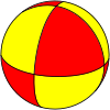
Re:The largest city in each 10x10 degree latitude/longitude box by mjevans on Thursday June 25, 2020 @08:35PM (#23647477)
https://en.wikipedia.org/wiki/Geodesic_polyhedron

For just shapes the above is a nice visual start.

However a striking feature of the linked article is how frequently there's a major city right near a cell edge.

A more useful list might be constructed by some process involving assigning a "city" an imprint size based on population, and a surrounding 'metro area' based on absorbing any weaker cities that overlap until the process either repeats or is matched by a neighboring city.

A starting point for results that are already similar to that: https://en.wikipedia.org/wiki/Metropolitan_area

The US specific list: https://en.wikipedia.org/wiki/List_of_metropolitan_statistic...

Re:The largest city in each 10x10 degree latitude/longitude box by hammock on Sunday June 28, 2020 @09:53PM (#23673664)
Yeah I was hoping there was a shape more interesting than a triangle (or a soccer ball)... Those rounded squares and rounded triangles were the best I could find.

I like that idea of building the regions bottom-up.

Re:The largest city in each 10x10 degree latitude/longitude box by joshvm on Thursday June 25, 2020 @09:46PM (#23647903)
The South Pole is a particularly interesting case. Clearly the Pole itself is 90 South and the choice of longitude is arbitrary there. However, Amundsen-Scott station, which is a hundred odd metres away, happens to be at ~140 E (89.997553 S!) and due to the map projection it appears as if it's in a totally different place.

It would be interesting to see an interactive version with a free choice of meridians.

Re:The largest city in each 10x10 degree latitude/longitude box by oh_sigh on Thursday June 25, 2020 @06:30PM (#23646510)
But they are rectangles on the projection - they just aren't rectangles if you map the projection back onto the globe.
Re:The largest city in each 10x10 degree latitude/longitude box by wcarey on Thursday June 25, 2020 @11:29AM (#23641817)
A fun thought experiment is to noodle through whether, given the method of choosing cities described, the choice of map projection would influence the resulting list of cities.
Re:The largest city in each 10x10 degree latitude/longitude box by greggyb on Thursday June 25, 2020 @03:57PM (#23644881)
Latitude and longitude exist as boundaries outside the domain of map projections. A different projection may draw these lines or curves differently, but they still delineate the same geographic boundaries. E.g. a different projection may not show rectangles, but instead curved regions, but the cities existing in those regions would be the same.

If you are thinking of drawing arbitrary rectangles on arbitrary projections, then you'd have to come up with a rigorous way to define your rectangles. If you don't, then you're just drawing random shapes on other random shapes. Either way, yes, a different projection with the same rectangles drawn over it would yield different answers, and this should be immediately obvious.

Re:The largest city in each 10x10 degree latitude/longitude box by jobigoud on Friday June 26, 2020 @06:19PM (#23657702)
Even the exact same projection but a slightly shifted 0° meridien would yield a completely different list of cities.