Re:DNA analysis reveals there are four distinct giraffe spec...
by Retric on Friday September 09, 2016 @06:38PM
(#12466537)
http://www.global-greenhouse-warming.com/images/SahulLGM.jpg... shows a fairly wide gap between Australasia and Europe. "However, Sahul and Sundaland even at the height of the LGM were separated by at least 80 kilometres (50 miles)." Last thing I read suggested the gap was ~100 miles though this may have been a more recent period.
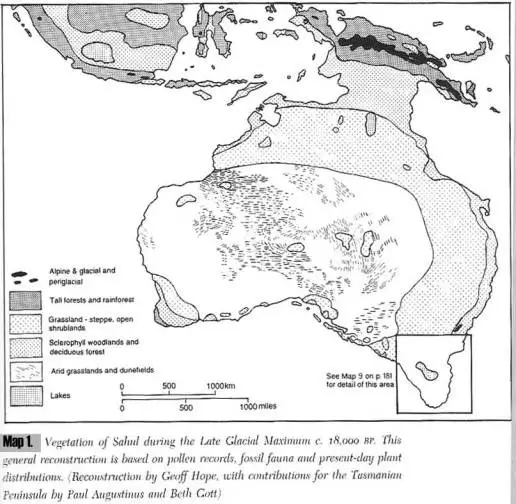
Thus, a 50 mile gap between Asia and the United states was likely crossed a few times.
For substantial periods of the past 50k years, Australia, Indonesia, and the South Indian subcontinent were joined or nearly so, due to lower sea levels. Much of the area remains quite shallow. At about 15-20kya:
http://www.global-greenhouse-warming.com/ice-ages-and-sea-le...
https://upload.wikimedia.org/wikipedia/commons/1/19/CLIMAP.j...
Australasia[edit] The Australian mainland, New Guinea, Tasmania and many smaller islands comprised a single land mass. This continent is now referred to sometimes as Sahul. Between Sahul and Sundaland – a peninsula of South East Asia that comprised present-day Malaysia and western and northern Indonesia – there remained an archipelago of islands known as Wallacea. The water gaps between these islands, Sahul and Sundaland were considerably narrower and fewer in number.
https://en.wikipedia.org/wiki/Last_Glacial_Maximum