Isn't it closer to the Tundra (Тундра [in rus]) orbit?
https://en.wikipedia.org/wiki/Tundra_orbit
Found a video showing the difference in ground tracks between the two:
Molniya is cheaper, certainly, and has the interesting property of dwelling over both the United States and Russia. Tundra orbit is aggressively regional, and thus has no plausible deniability about being for local use. If you're not a Cold Warrior, however, that doesn't matter much, so we'll probably see more Tundra type systems in the future. Europe would benefit from this exact system, as would the US. China perhaps, too.
As far as "should be useful" goes do you know if Japan has ground stations in Australia?
http://www.insidegnss.com/auto/popupimage/QZSS%20ground%20se...
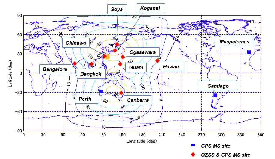
Dunno if those will help with the "centimeter resolution" bit, but it'll certainly augment GPS.
The dwell over Australia and other non-Japan areas for the non-stationary sats will be shorter, but still will be useful while they are visible. And outside of "canyon" areas that will be quite often. The geostationary sats will be useful over quite a lot of the west Pacific and east Indian oceans.
The geosynchronous part is so that they only need a few sats to cover their region, unlike GPS which is global and requires some 32 sats.
It's not an equatorial geostationary orbit so that receivers at higher latitudes (in Japan) will see a sat overhead instead of always over the equator. This is to deal with the "canyon" effect. Guaranteeing a bird overhead, rather than GPS's catch-as-catch-can, should definitely help signal reliability.
These will be further away than GPS, which are medium Earth orbit.
Some other info (including an animation) here:
http://global.jaxa.jp/countdown/f18/overview/orbit_e.html
It should also be useful in Australia and parts between. They will also park spare sats in geostationary equatorial orbits.
It's a bit inspired, I think, by the Molniya orbit, another technique to get long-duration high-latitude overflight:
http://en.wikipedia.org/wiki/Molniya_orbit