They "Go to google, type what they want, google gives it to them."
Sure, you could click on the 9 dots on the top right and select maps for google maps.
But is that always there on every device, on every web browser, whether signed in with google account or not?
Apple has the only viable alternatives to those two, and the only way they are able to distribute them is because they control the home screen of iOS.
That is not my memory. Google maps used AJAX to let you pan around. It was fluid, and really nice. What I had been using up until then was MapQuest, where you needed to click an arrow to move around, with long delays.
Disclosure: I work for Google
It would have been easy to offer kml links and "force" the users into Google Earth. Before it was tinkered into a steaming pile of shit Keyhole was a truly fantastic product, with a lovely community, arguably the greatest thing since web browsers (with picasa & hello as a close 3rd and 4th)
For a web based thing the ajax maps was quite nice but today I really hate using it. The data is great tho and you cant complaint about the price.
How so?
Take route planning for example. It use to be that you could fly the route in google earth. A line on a paper like map with a bunch of dots is useful for finding a shorter or more preferable route but after you've made up your mind flying over the road from A to B allows you to drive or cycle without any map.
If the application is installed the search results can include tours. (people made countless illustrated tours that kept breaking with each api update until there were no tours left)
Google could probably embed google earth into web pages if the will was there.
We will see where https://earth.google.com/web/ ends up. For now it loads as if booting an OS but its quite smooth after that.
The other options were just as good, but often you had to pay for them. With Google, you could repeatedly refine the bad results until you found something useful, because there was zero additional cost involved.
Maps had smooth, animated panning and zooming that updated the map in real time without reloading the page. MapQuest and the other major competitors at the time only allowed panning and zooming by clicking buttons on the side of the map, which scrolled a predefined number of steps and reloaded, at least initially, the entire page when you did so.
Google Maps was also less cluttered and used the browser's real estate much effectively. MapQuest was a small, cramped map by comparison.
Screenshots:
https://i2.wp.com/www.matthewhurst.com/wp-content/uploads/20...

https://www.versionmuseum.com/images/websites/google-maps-we...
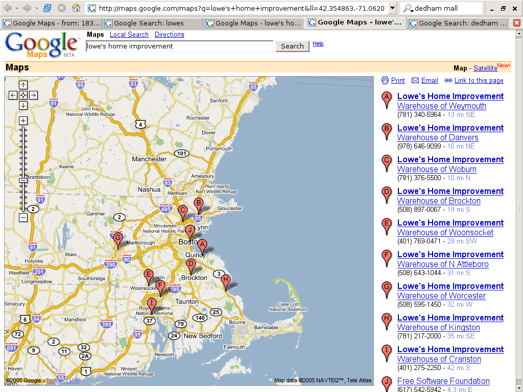
And when GMaps first started, it wasn’t the beast that it was today; sure it had some nifty UX improvements, but it was nothing close to competitors in the space at the time.