Re:City street orientations around the world
by smcl on Friday July 13, 2018 @06:20AM
(#17521747)
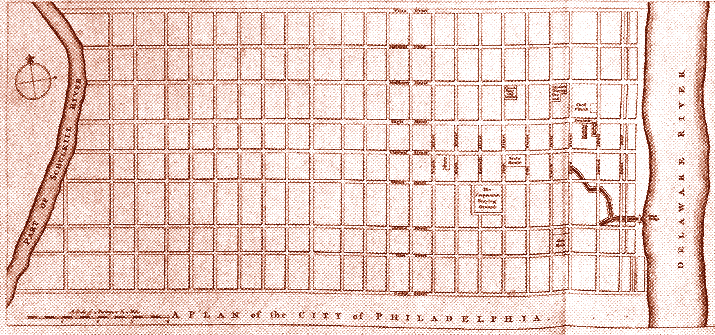
Anyone know why Philadelphia has a kinda NSEW orientation like the other cities but rotated ever so slightly? Manhattan is similar and it makes sense (they are aligned with the island itself), but Philadelphia is so close to the actual compass points and not aligned with anything really else.
[ Parent
| on HN ]
Re:City street orientations around the world
by blatherard on Friday July 13, 2018 @06:35AM
(#17521800)
As I understand it, the grid plan originated in Philadelphia in a stretch of land between the Delaware and Schyulkhill rivers. This portion, which is now generally called Center City, has a grid that aligns itself with the Delaware which runs at that point a little East of North. The rest of the city grew up extending that grid.
Re:City street orientations around the world
by madcaptenor on Friday July 13, 2018 @01:51PM
(#17525090)
Also, that particular point was picked, I believe, because it was the shortest distance between the Delaware and the Schuylkill. (Well, except for a few miles downriver where the Schuylkill flows into the Delaware, but South Philly was basically swamps back then.) See for example https://hiddencityphila.org/2015/08/courtyard-compass-reveal...
Re:City street orientations around the world
by mirimir on Friday July 13, 2018 @06:57AM
(#17521867)
The ~same offset appears in Penn's original plan.[0]
Maybe it was based on geomagnetic north? The magnetic declination in Philadelphia is now about -13 degrees, but it was maybe -8 degrees in 1682.[1]
0) http://www.ushistory.org/philadelphia/images/philadelphia1.g...